Software for Terrain Mapping
TerrainCartography.com is dedicated to relief mapping. We are currently offering various free and open-source software application for topographic mapping in 2D and 3D.
TerrainCartography.com is maintained by Bernie Jenny, Monash University.
Eduard creates beautiful and accurate Swiss-style shaded relief images for maps.
Pyramid Shader creates shaded relief, illuminated and shadowed contour lines, hypsometric tints, exposition colors, bivariate colors, and other visualizations.
Plug-ins for ImageJ to read and write files in ESRI ASCII grid format.

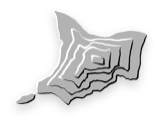
Scree Painter generates scree patterns for topographic maps. It fills polygons with scree stones for Swiss-style mountain maps. For Windows, Mac and Linux.
Terrain Bender curves digital elevation models to simulate progressive perspective in 3D maps. For Windows, Mac and Linux.


Terrain Sculptor generalizes digital terrain models for relief shading. For Windows, Mac and Linux.
Terrain Equalizer generalizes digital terrain models for 3D maps. Currently only a pre-release.